Key takeaways
- In June 2025 Bellevue renamed its residential zones. R-1 through R-30 are now LL-1 and LL-2, SR-1 to SR-4, LDR-1 to LDR-3, MDR-1 and MDR-2. R-3.5, for example, is now SR-2.
- Outside the two large-lot zones the front setback is 20 feet. Side yards are at least 5 feet, usually 15 feet combined, and the rear yard is 20 or 25 feet.
- A house may be 30 feet to a flat roof or 35 feet to a pitched ridge, from average existing grade, and no facade may exceed 40 feet.
- Floor area ratio caps one house at 0.5 of the first 10,000 square feet of lot plus 0.3 of the rest: 8,000 square feet on a 20,000 square foot lot.
- In a 2024 Lake Washington decision the city applied a 50 foot shoreline setback from the ordinary high water mark, reducible to 25 feet with mitigation.
Short answer: on a typical Bellevue single-family lot, the Land Use Code lets you build a house with floor area of up to half the lot (less above 10,000 square feet), 30 to 35 feet tall, covering 35 or 40 percent of the lot and set back 20 feet from the street. The exact numbers depend on your zone, and every zone was renamed in 2025. On the lake, on a slope or among big trees, more rules apply on top.
For how I work in the city, see the Bellevue architect page. The figures below come from Bellevue’s Land Use Code (LUC) as amended by Ordinance 6851 (adopted June 24, 2025) and later ordinances through July 2026, and city guidance pages, as of September 2026. The code keeps changing, so confirm with the city before relying on a number.
Bellevue’s residential zones, renamed in 2025
When the City Council adopted its middle housing ordinance under state laws HB 1110 and HB 1337, it also renamed every residential zone. The old names counted units per acre; the new ones follow the city’s updated land use categories. Plats and older permits still use the R names, so here is the translation.
| New zone | Old name | Minimum lot | Minimum width |
|---|---|---|---|
| LL-1 | R-1 | 35,000 sq ft | 100 ft |
| LL-2 | R-1.8 | 20,000 sq ft | 90 ft |
| SR-1 | R-2.5 | 13,500 sq ft | 80 ft |
| SR-2 | R-3.5 | 10,000 sq ft | 70 ft |
| SR-3 | R-4 | 8,500 sq ft | 65 ft |
| SR-4 | R-5 | 7,200 sq ft | 60 ft |
| LDR-1 | R-7.5 | 4,700 sq ft | 50 ft |
Source: LUC 20.10.020 and Chart 20.20.010 as amended by Ordinance 6851; name mapping from the city’s April 2025 staff report. LDR-2, LDR-3, MDR-1 and MDR-2 (formerly R-10, R-15, R-20 and R-30) are the higher density zones. Unless I say otherwise, the numbers below are for LL-1 through LDR-1.
Finding your zone on the Bellevue zoning map
The city’s PDF Maps page carries a citywide zoning map with parcels, and its open data site publishes a Zoning layer. That PDF is dated July 25, 2025 and uses the new zone names. For a written answer, request a zoning verification letter on MyBuildingPermit.com (Land Use, Preapplication Services, Zoning Verification), or call Development Services Land Use at 425-452-4188. If anything about a lot is in doubt, get the letter before you close.
Pull the recorded plat too. The city notes that plat conditions sometimes set larger setbacks than the zone.
Bellevue setback requirements by zone
| Zone | Front | Rear | Each side | Sides combined |
|---|---|---|---|---|
| LL-1 | 35 ft | 25 ft | 5 ft | 20 ft |
| LL-2 | 30 ft | 25 ft | 5 ft | 15 ft |
| SR-1 and SR-2 | 20 ft | 25 ft | 5 ft | 15 ft |
| SR-3 and SR-4 | 20 ft | 20 ft | 5 ft | 15 ft |
| LDR-1 | 20 ft | 20 ft | 5 ft | 10 ft |
Source: Chart 20.20.010 as amended by Ordinance 6851. The city’s setbacks page gives the same figures for its R-5 (now SR-4) example.
The combined side yard shapes the plan. On a 70 foot wide SR-2 lot, 15 feet of side yards leaves 55 feet of width (70 minus 15), split 5 and 10 or 7.5 and 7.5. The front setback runs from the inside edge of the right of way, and the city warns your line is often several feet behind the curb. A corner lot on two public streets has two fronts, and every lot keeps at least 10 feet from a right of way, access easement or private road. Relief usually means a variance (LUC 20.30G), which has strict criteria.
What can sit inside a setback (LUC 20.20.025)
- Eaves, decks, porches, balconies, bay windows and chimneys 30 inches or more above grade may project 18 inches or 20 percent of the setback, whichever is greater. On a 20 foot front setback that is 4 feet (20 x 0.20). Lower elements may go anywhere in the setback.
- Except for eaves, projections may run no more than 25 percent of that facade’s length, and they may not add floor area.
- Heat pumps, and retaining walls or rockeries 30 inches or taller, are not minor elements; such walls may enter a setback only where the grade leaves no feasible alternative (LUC 20.20.025.D).
- On a steep lot a garage may come to within 5 feet of the front line if the setback would put it 8 feet or more above the street with no reasonable driveway up, or if no driveway under 15 percent grade can reach a house below the street.
Bellevue height limit for houses
A house may be 30 feet tall to the top of a flat roof or 35 feet to the ridge of a pitched roof. A roof pitched under 2:12 counts as flat. Height is measured from the average existing grade: spot elevations of the existing ground every 10 feet around the footprint, averaged. Chimneys, antennas and flagpoles are excluded, and since July 2026 roof solar panels may exceed the limit by at least 48 inches (LUC 20.20.525.D). The chart allows 40 feet in LDR-2 through MDR-2. Shoreline lots: also check LUC 20.25E.
A second test applies to new houses and additions: no single facade may exceed 40 feet from existing grade at the base of that wall to the ridge or flat roof. Lots created by a full subdivision or planned unit development are exempt; short plat lots are not.
The facade rule bites on a slope. If the ground at a downhill wall is 6 feet below average grade, a ridge at the full 35 feet stands 41 feet above that wall’s base (35 plus 6), one foot over the limit.
Lot coverage, impervious surface and greenscape
| Zones | Lot coverage | Impervious surface | Hard surface |
|---|---|---|---|
| LL-1 to SR-3 | 35% | 45% | 75% |
| SR-4 and LDR-1 | 40% | 55% | 80% |
Source: Chart 20.20.010 and Note (37) as amended by Ordinance 6851. The chart also lists alternative impervious maximums; ask the city whether your lot qualifies.
The three caps nest: the footprint counts inside impervious surface, and impervious surface counts inside hard surface. Coverage includes the house, accessory buildings and decks more than 30 inches above finished grade, and the city calculates it after subtracting critical areas and their setbacks from the lot area.
On a 10,000 square foot SR-2 lot that is a footprint of up to 3,500 square feet (35 percent) and 4,500 square feet of impervious surface (45 percent). A house using its full footprint leaves 1,000 square feet for the driveway, walks and patios, unless some are pervious or fall under the exceptions in LUC 20.20.460.
Then greenscape: at least 50 percent of the front yard setback must be greenscape, as the code defines it in LUC 20.50.022, whenever a permit is needed. Front yards built before January 1, 2008 that fall short are not nonconforming, but cannot be reduced further.
Floor area ratio: how big the house can be
House size is set by LUC 20.20.390, added in 2025. It applies to new houses, detached ADUs and additions of 20 percent or more over the floor area permitted under the original approval. For one house, the floor area ratio (FAR) is 0.5 on a lot of 10,000 square feet or less. On a bigger lot, 0.5 applies to the first 10,000 square feet and 0.3 to the rest.
| Lot size | Calculation | Maximum floor area |
|---|---|---|
| 8,500 sq ft | 8,500 x 0.5 | 4,250 sq ft |
| 10,000 sq ft | 10,000 x 0.5 | 5,000 sq ft |
| 13,500 sq ft | 5,000 + (3,500 x 0.3) | 6,050 sq ft |
| 20,000 sq ft | 5,000 + (10,000 x 0.3) | 8,000 sq ft |
| 35,000 sq ft | 5,000 + (25,000 x 0.3) | 12,500 sq ft |
Source: Table 20.20.390.B.1, Ordinance 6851. FAR is measured against net on-site land area.
Gross floor area is measured to the inside face of the exterior walls and includes every story of every building on the lot. Rooms 18 feet or taller count twice. Lower levels less than 5 feet above finished grade, unfinished attics, carports, porches and decks are excluded. A 500 square foot great room with a 20 foot ceiling uses 1,000 square feet of allowance; how a sloping lot’s lower level is counted is worth settling with the city early.
This is a real change. Before 2025, 0.5 was a threshold: a house could exceed it by keeping 7.5 foot side yards and adding a 5 foot second story stepback or a daylight plane. That option is gone. For a remodel, note the trigger: on a house originally permitted at 3,000 square feet, an addition of 600 square feet or more (3,000 x 0.20) brings the cap into play.
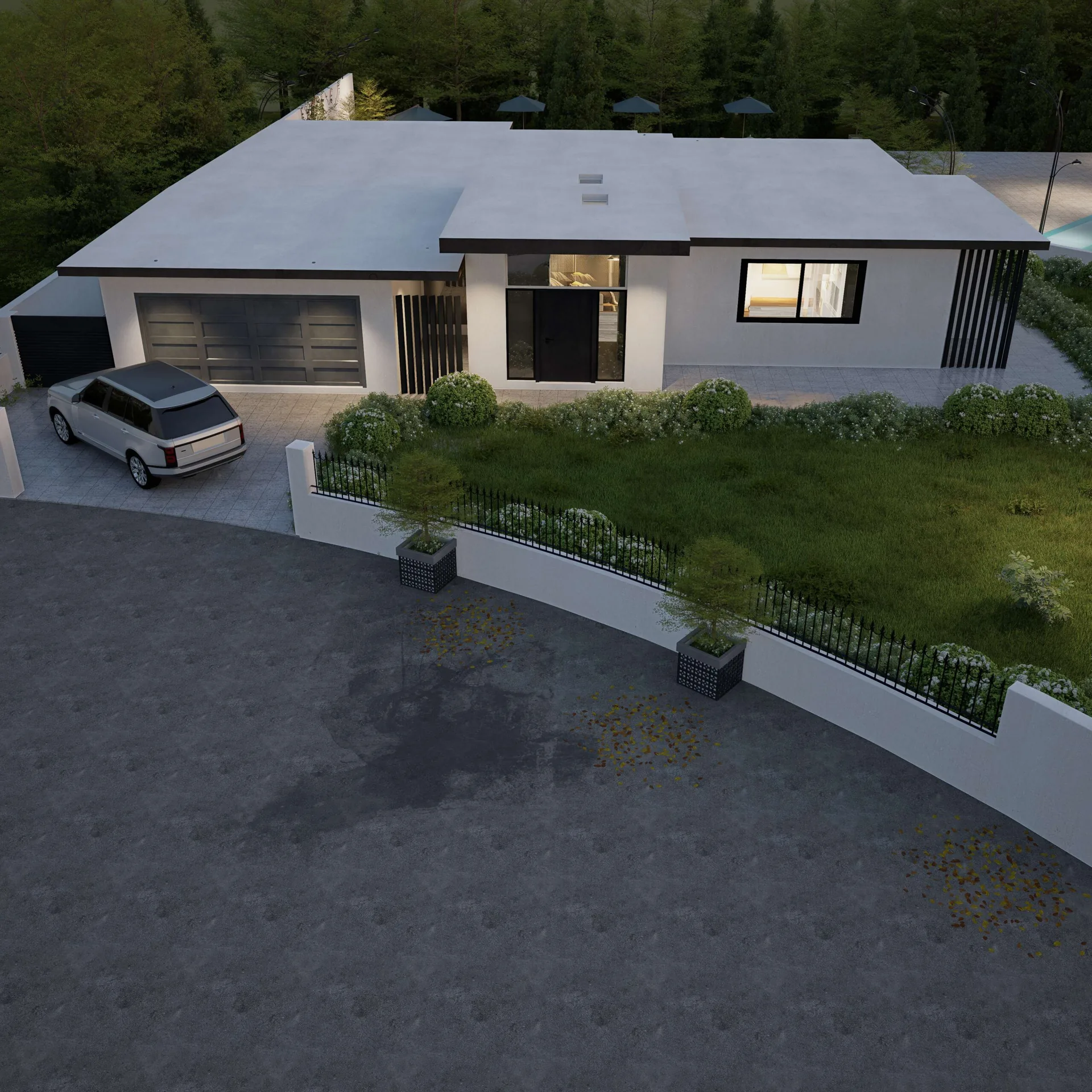
Garages, sheds and ADUs
On lots under 20,000 square feet, detached accessory structures follow LUC 20.20.125; on bigger lots they meet the zone’s normal setbacks. The city’s rules for smaller lots: at least 10 feet from a right of way or access easement, the house’s front and side setbacks, 5 feet from the rear line, generally 15 feet tall at most and no more than 10 percent of the lot, counted in coverage. With a neighbor agreement recorded with King County, a structure up to 15 feet tall can sit on a side or rear line, subject to conditions. A structure under 200 square feet may skip the building permit but must still meet zoning.
Under LUC 20.20.120, up to two ADUs are allowed on each lot where a house is allowed, each up to 1,200 square feet. An attached ADU follows the house’s height and setbacks, and its floor area does not count toward FAR. A detached ADU is limited to 24 feet (28 over an existing accessory structure), uses the middle housing standards, and counts toward FAR and the unit count.
That last point matters on large lots. Table 20.20.390.B.1 gives two units a FAR of 0.5 on a lot over 10,000 square feet, with no 0.3 step. As I read it, a 20,000 square foot lot with a house and a detached ADU may carry 10,000 square feet in total (20,000 x 0.5), against 8,000 for the house alone. Confirm that with the city before designing around it.
What the 2025 zoning changes mean for your lot
Every residential lot now allows up to four units, and six within a quarter mile walk of a major transit stop or a regional or countywide growth center, or where two units are affordable. Middle housing (two to six attached, stacked or clustered units, plus cottage housing) has its own table in LUC 20.20.538: a 10 foot front setback in SR-1 and above, 10 or 15 foot rear, 32 feet to a flat roof or 35 to a ridge, 40 or 45 percent coverage, and a FAR of 1.0 for four units on a lot up to 10,000 square feet. Since January 2026 it also covers critical areas overlay lots, subject to LUC 20.25H.
Building one house, you design to Chart 20.20.010 and the FAR cap. The change matters in two ways: your neighbor may build more than you expect, and a teardown lot now has options, such as a second unit for a parent. More in my note on middle housing on the Eastside.
Lakefront lots on Lake Washington and Lake Sammamish
In Bellevue the Shoreline Overlay District (LUC 20.25E) covers Lake Washington, Lake Sammamish, Lower Kelsey Creek and Phantom Lake, on top of the zoning above.
- Setback. In a January 2024 decision on a Lake Washington teardown and rebuild, the city applied a 50 foot shoreline structure setback from the ordinary high water mark (OHWM), which the code lets drop to 25 feet where shoreline vegetation impacts are mitigated under LUC 20.25E.065.F.
- Near the water. The same decision capped impervious surface at 50 percent within 50 feet of the OHWM.
- Lake Sammamish. A 2022 decision measured the OHWM from elevation 31.8 feet on the NAVD vertical datum.
A lakefront lot can also carry a steep slope behind the house, and its buffer can push the house toward the water line. See custom homes in Bellevue and lakefront design on Lake Washington.
Trees and critical areas
Bellevue updated its tree code in 2024 and adjusted it again in July 2026. LUC 20.20.900 sets a minimum tree density that a new house or a larger addition must meet by keeping trees, planting them or both, and the site plan must show every tree with species, diameter, protection zone and a tree credit calculation. Bridle Trails is on the citywide rules, and permits are still needed there to remove significant or landmark trees. More in the tree ordinance guide, which has a Bellevue section.
Critical areas (LUC 20.25H), such as wetlands, streams and steep slopes of 40 percent or more, carry their own buffers and structure setbacks. Check the city’s maps for them first.
How zoning feeds the permit
Zoning is checked at plan review, mostly from the site plan. The city’s checklist asks for labeled setbacks, FAR and coverage calculations, impervious and hard surface totals, a height table from grade elevations no more than 10 feet apart, all trees, and critical areas with buffers. Land use approvals, such as a critical areas or shoreline permit, usually come before the building permit and can take several months. The steps are in my Bellevue building permit guide.
For planning I use Seattle’s permit times as a benchmark, 6 to 10 months for a new house and about 2 to 3 months for a remodel, and 18 to 30 months from design start to move-in, with demolition on a teardown typically $20,000 to $50,000. These are planning ranges; see the custom home timeline and what it costs to build a house.
I put every rule above on one site plan before design starts, so the house is drawn inside the real envelope. Piper Cole designs houses and administers construction on your behalf; it does not build them.
Before you design
Find out what your Bellevue lot will carry
Send me the address and what you have in mind. I will tell you which of these rules is likely to decide your house and what to check first.
Questions
What is the zoning code in Bellevue, WA?
Bellevue’s zoning code is the Land Use Code, Title 20 of the city code. Residential dimensions such as setbacks, height, lot coverage and minimum lot size are in Chart 20.20.010, and house size is capped by floor area ratio in LUC 20.20.390. In June 2025 Ordinance 6851 renamed the residential zones: R-1 through R-30 became LL-1, LL-2, SR-1 to SR-4, LDR-1 to LDR-3, MDR-1 and MDR-2. Confirm current rules with the city.
What are the setback requirements in Bellevue?
In SR-1 through LDR-1 the front setback is 20 feet; it is 35 feet in LL-1 and 30 feet in LL-2. Rear setbacks are 25 feet in LL-1 through SR-2 and 20 feet in SR-3 and above. Every zone requires 5 feet on each side, with combined side yards of 20 feet in LL-1, 15 feet in LL-2 through SR-4 and 10 feet in LDR-1 and above. Any lot keeps at least 10 feet from a right of way, access easement or private road, as of September 2026.
What is the height limit for a house in Bellevue?
In the LL-1 through LDR-1 zones a house may be 30 feet tall to the top of a flat roof or 35 feet to the ridge of a pitched roof, measured from the average existing grade around the building. Roofs pitched under 2:12 count as flat. Separately, no single facade of a new house or addition may exceed 40 feet from existing grade at its base, except on lots created through a full subdivision or planned unit development.
What is R-3.5 zoning in Bellevue now?
R-3.5 was renamed SR-2 in 2025. SR-2 requires a lot of at least 10,000 square feet and 70 feet wide, with a 20 foot front setback, 25 foot rear setback and 5 foot side setbacks totaling 15 feet. Lot coverage by structures is capped at 35 percent, impervious surface at 45 percent, and height at 30 feet flat or 35 feet pitched. A single house on a 10,000 square foot lot may have up to 5,000 square feet of floor area.
How big a house can I build in Bellevue?
For one house, Bellevue’s floor area ratio is 0.5 on a lot of 10,000 square feet or less. On a larger lot, 0.5 applies to the first 10,000 square feet and 0.3 to the rest, so a 20,000 square foot lot allows 8,000 square feet. Rooms 18 feet or taller count twice, while lower levels less than 5 feet above finished grade, unfinished attics, porches and decks are excluded. Coverage, setbacks and height limits also apply.
Where can I find the Bellevue zoning map?
The City of Bellevue posts a citywide zoning map on its PDF Maps page and publishes a Zoning layer on its open data site. That PDF is dated July 25, 2025 and uses the new zone names; older plats and permits still use R labels, which need translating. For a written answer, request a zoning verification letter through MyBuildingPermit.com, or contact Development Services Land Use at 425-452-4188.
How close to the lake can I build in Bellevue?
Lots on Lake Washington and Lake Sammamish are in the Shoreline Overlay District, LUC 20.25E. In a 2024 Lake Washington decision the city applied a 50 foot shoreline structure setback from the ordinary high water mark, which can be reduced to a minimum of 25 feet if impacts to shoreline vegetation are mitigated. The same decision capped impervious surface within 50 feet of the ordinary high water mark at 50 percent. Confirm the current figures with the city for your lot.
What zoning changes did Bellevue make in 2025?
On June 24, 2025 the City Council adopted Ordinance 6851 to implement state laws HB 1110 and HB 1337. It renamed the residential zones, allowed up to four units on every residential lot and six near major transit stops and growth centers or with affordable units, allowed up to two ADUs per lot, and turned the old 0.5 floor area threshold for houses, which could be exceeded with wider side yards and a stepback, into a maximum floor area ratio in LUC 20.20.390.
Authoritative sources
Regulatory requirements referenced in this guide are set by the official agencies below. Rules change, always confirm current requirements with the source: